
ITINERARIES AND PROPOSALS

TOURIST GUIDE

The ideal period? You can enjoy Cesana all year round!

Piedmont offers a variety of cultural, food and wine and sporting itineraries that embrace every type of interest. The wealth of its historical, artistic and architectural heritage

A natural bridge to Europe, the Susa Valley harbours an immense heritage of mountain art and culture which, together with the natural beauty of the mountains and of the forests on the valley floor, makes the land extraordinary and unique. Located in the western sector of the Piedmontese Alps, the Susa Valley is the dividing element between the Cottian and the Graian Alps, which begin at the Moncenisio Pass. The valley is crossed by the Dora Riparia, into which the waters of the Ripa di Cesana, the Piccola Dora di Claviere and the Dora di Bardonecchia flow.

MOUNTAINEERING - ROCK CLIMBING

Routes for climbing mountains and walls

Falesia Rocca Clarì

The small falesia di Rocca Clarì is undoubtedly the least known cliff in the valley, even though it has been used for decades by the Alpine Troops of the Bousson Barracks for climbing practice, roughly equipped with normal pitons and a few bolts at the belays.

In recent years, a full review of the sector by the Alpine Regiment of Bousson Barracks has led to the re-equipping of all the itineraries with quality materials, which has given the cliff a new lease of life. The cliff is located in the gorges formed by the Piccola Dora stream that drops down from Claviere towards Cesana, below the avalanche protection tunnels on the Mongenève state road. The fairly high altitude of about 1500 m, the proximity to the water, the position, which lets in only a few hours of sunshine during the day, make it an excellent alternative in periods of great heat. It is made up of 4 consecutive sectors, positioned close to the stream, a very convenient wooden footbridge allows transit from one area to another. The first section, called “A”, is great in terms of difficulty and consists of an almost vertical slab of limestone with plenty of holds.

The rock is a grey limestone, very dark and variegated, where we find in a small way, all climbing styles: resting plates, vertical walls, dihedrals and cracks. The height of the pitches varies between 15 and 22 metres. The pitons, made with top class 10 and 12 mm spi-fixes, are often, and rightly so, close together, given the conformation of the rock and the difficulties. The abseils are always equipped with chains and rings, and some belays are positioned in large trees. Top-rope abseiling is sometimes awkward, but always possible due to the conformation of the wall.

In short: a new/old cliff, set in a quiet, special and cool environment characterised by good rock and easy, well bolted pitches.

Access

From Cesana Torinese in the upper Susa Valley, head towards Claviere along the Montgenève state road as far as the bridge over the Piccola Dora and leave your car in the extensive clearing on the left. Continue along the river by dirt track which after a few hundred metres becomes a path, then a recently built footbridge which soon leads to the first sector of the cliff 5 minutes from the car. The first routes start on the footbridge.

Falesia Gorge di San Gervasio

A new sector equipped in autumn 2008 by the Alpine Corps’ team of mountaineering instructors.

The intention of the instructors was to create an area suitable for training the troops, rather than a typically sporting cliff. The area is located in the San Gervasio Gorge, between Cesana and Claviere, along the banks of the Piccola Dora stream. The wall is vast and highly diversified, the left side consisting of a series of dihedrals and pronounced edges, the part immediately to the right of the new Via Ferrata di Rocca Clarì, like a large, imposing-looking slab, and further to the right again an easy, bolted outcrop closes the sector.  The grey limestone rock is, on the whole, sufficiently solid, but clearly given the quality of the structure, especially in the easier, flattened areas, close attention is essential. The place is characteristic, situated at an altitude of about 1600 metres, cool and always well ventilated, therefore suitable only in summer. The equipment is entirely made up of 10 mm spit-fixes with abseil slings. Pitch length is never excessive, so a 70 metre rope is always enough.

Access

From Cesana Torinese in the upper Susa Valley, head towards Claviere along the Mongenève State Road as far as the bridge over the Piccola Dora and leave your car in the extensive clearing on the left. Continue along the river by a dirt track that after a few hundred metres becomes a path, then a recently built footbridge that soon leads to the Falesia di Rocca Clarì. Once past this, continue along the path into the gorge, pass another wooden footbridge on the bank of the stream and then for a few more minutes proceed along the path until you find the cliff on the left, which is at the start of the Via Ferrata di Rocca Clarì 15 min.

Falesia Remolon

A bolted cliff used by the Alpine Troops of the Bousson Barracks as a climbing wall. It must be said that the site is particularly beautiful, immersed in mountain vegetation with tall trees typical of the area which lies at an altitude of almost 2200 metres. The special feature of the cliff is that it abounds in very easy routes, so it is ideal for starting out in rock climbing and above all for practicing rope manoeuvres, from top roping to climbing party progression, from abseiling to rescue and recovery manoeuvres on the wall. It is made up of three distinct but very close sectors, the first, the highest, with 4 routes of two lengths each, for a total height of 50 metres, the second with 5 single pitch lengths of around 30 metres and the third with a couple of 20 metre pitches, which are also highly attractive, but of above average difficulty.

The wall is a large, sloping face of granite rock, highly bolted and solid, the style of climbing is obviously the inclined face full of footholds and holds, the equipment is excellent, in the first sector, 10 mm Spit-Fix with chains and maillons at the belays, the same for the second sector, with the only drawback that the belays and therefore the abseils are positioned far back from the edge of the wall which makes top roping awkward. (It was not designed for this).

Located at an altitude of 2200 m in the beautiful woods of the Monti della Luna and with a southern exposure, the cliff is only accessible in the summer.

Access

From Cesana Torinese in the upper Susa Valley, head towards Claviere along the Montgenève state road. A few hundred metres before the bridge over the Piccola Dora you will come to the turn off for Sagnalonga on the left (dirt road); take it till you reach the village, several kilometres of good carriage road, continue in the direction of Colle Bercia until you come to the wooden notice board with the indication “Rocca Remolon punto panoramico” (Rocca Remolon panoramic viewpoint). Plenty of space on the sides for parking. Go up the short path to the top of the rock and descend on the opposite side where you will find the first sector, 3 minutes from the car, a little further on you will find the second and third sectors.

Falesia Lago Nero

Yet another delightful cliff face in one of the most beautiful corners of the valley, the Conca del Lago Nero, the classic alpine environment characterised by gentle grassy slopes interspersed with lush pine and larch forests reflected in the waters of the lake. The sectors are located some distance apart so that, even on days when tourists abound, the climber can still find peace and quiet. The rock is very special because, although it belongs to the quartzite family, it is rich in limestone-like indentations and holes, as well as granite-like cracks. The three sectors, very close to each other, have completely different morphologies, the first with three very easy lengths ideal for beginners, the second, about fifteen metres high with vertical-technical routes, the third, larger, characterised by a first part, which goes from 10 to 15 metres overhanging, then on slightly sloping faces, with routes of all degrees, reaching 25 metres in height.

Obviously not all that glitters is gold and the sore point is that the rock is covered with lichen in the more equipped sections which can annoy the climber, and often the holds are very sharp, to the point of becoming painful. Complicit in all this is the low number of visitors, which however is not always a bad thing. The cliff has recently been equipped by the Alpini of the Bousson Barracks, with 10 mm. spit-fixes, belays and abseiling rings. The south-east exposure and the altitude of over 2000 m. make it practicable only in summer.

Access

From Oulx, reachable via the A32 Frejus motorway, head towards the Montgenève Pass as far as the village of Cesana. Do not turn towards the pass, but continue straight on through the urban area towards Bousson. When you reach Bousson, turn right towards Lake Nero, follow the signs. A long dirt road will take you to the beautiful green basin of Lake Nero. Follow the path around the lake and enter the small valley immediately after, the three sectors are on our right, a few hundred metres apart, and are not visible from the car park. 10 min.

Falesia Rhuilles

The small falesia di Rhuilles, located in the fabulous valley of Thuras, in Cesana Torinese territory, is the ideal place to spend a quiet summer day without for that reason neglecting your desire to climb. The place is truly beautiful, the wall stands at an altitude of about 1750 m., in a perfect alpine setting; moreover, the north-west exposure means that the sun arrives only later in the afternoon, so it is an ideal place to be during the hottest days of the year. The wall is small, the routes are highly concentrated and close together, and the height of the pitches is modest, between 10 and 15 metres. The rock is a dark limestone of mediocre quality, so little used that it is still dirty, especially in the upper section, basically a place to forget!!! 

Absolutely not. The more often you go there the more interesting it becomes. The lower section, the easiest and most climbed, is an almost vertical slab with technical routes on small neat holds. The upper section consists of a vertical or slightly overhanging wall, where climbing becomes even more technical, with a good mix of small clean holds and large loose plates. The pegging is excellent everywhere, with resin-bonded bolts and abseil rings at the belays. The difficulties indicated should not be considered as absolute truths, especially as regards the three routes that are very beautiful and grade 7. To reach the upper sector you can do one of the pitches below or climb up the broken rocks on the left. As a precaution, the two central routes in the upper section have not been indicated, as they touch on a boulder that could become dangerous. Basically, this is not a cliff on which to look for great performances or on-sight achievements, but a simple, unpretentious place to climb a day differently.

Access

From Oulx, which can be reached via the A32 Frejus motorway, head towards the Montgenève Pass as far as the village of Cesana. There you should not turn into the pass but continue straight on, going through the village and heading towards Bousson. When you get close to the Alpine Barracks in Bousson, turn right and follow the asphalt road to the hamlet of Thures, and on a bend, just below the buildings, take the dirt road to the Thures valley; after a couple of kilometres go through the hamlet of Rhuilles, continue along the dirt road until the end of the plateau where there is a sign indicating a climbing wall. The cliff is located immediately above, 3 min from the car. In the height of the summer season you may encounter a no-entry sign, just before the village of Rhuilles, in this case it is a 20 min. walk from the car park on level ground.

Falesia Griserie

Beautiful surroundings and guaranteed coolness characterise this little known and little climbed cliff.

The walls are located inside a small canyon, narrow and wild in the lower part, where we find the most difficult sector, with several grade seven pitches; while in the upper sector, it widens to form a superb grassy basin.

The high altitude of about 1900 metres, the eastern exposure which hides the sun from late morning, and the very windy location make this cliff perfectly suited for hot periods, but it is not recommended outside of summer.

As already mentioned, the cliff is divided into two sectors:

1 – Lower: here we find a dozen pitches of medium-high difficulty, the rock is a beautiful limestone, blackish in the vertical areas, which becomes red/yellow in the overhangs; routes that may seem mediocre in appearance, become very beautiful as soon as you start climbing. The pegging, although not impeccable, is more than acceptable. Generally speaking it is fairly mixed, in the sense that we find itineraries totally or partially bolted with resinated eyebolts, next to others equipped with 8-10 mm. bolts and fixes, that despite their not so young age, still give security. The length of the pitches is around 20-25 metres, with some reaching almost 30 metres.

2 – Higher, broader and more open, distinguished by a beautiful greyish limestone rock, which in the upper part of some routes becomes superb, given the perfectly vertical conformation and the wealth of concretions, flat tops and enormous flared discs. There are some grassy ledges on the wall, which in practice do not disturb the climb too much. Almost all the routes consist of two pitches, which can be climbed with a single length of rope, the height thus becomes 30 – 35 metres and about fifteen quick draws are required; lowering off from high belays is not always convenient, as some routes were designed to be climbed with two lengths of rope and abseiled down. The pegging follows the style of the lower sector, therefore partly with resin-coated eyebolts and partly with traditional expansion bolts (8 and 10 mm), on the whole however always good, what can be said is that on some routes we find an old fashioned spacing between the protections, therefore not very homogeneous and with the first pitons sometimes high. The first five routes in this sector were recently re-equipped by the Alpine Military Instructors stationed at the Bousson Barracks.

Access

From Oulx, reachable via the A32 Frejus motorway, head towards the Montgenève Pass until you get to Cesana, where you should not turn into the pass but continue straight on through the urban area towards Bousson. When you arrive near the Alpini Barracks, in Bousson, turn right and take the asphalt road to Thures. At the bend, just below the buildings, take the dirt road to the Thures valley. After a couple of kilometres go through the hamlet of Rhuilles and continue along the dirt road to the end of the plateau.  

Here we find an indication “Palestra di roccia” (Practice ground for rock climbing), but this does not refer to the Griserie cliff, so continue along the dirt road, which now climbs up with some bends, becoming more uneven. After a couple of kilometres you come to a small wooden bridge, after which there are some parking spaces. Alternatively, you can leave the car at the end of the plateau and walk along the twisty path (20 min.).  From the small bridge follow the path indicated, “Palestra di roccia”, after a few minutes cross the stream on the left and head towards a mound, the entrance point to the canyon, descend briefly into the grassy basin reaching the upper sector, 10 min. from the car, for the lower sector descend again along the gorge for a few minutes.

Ferrata dei Militari o del Bunker

San Gervasio Gorge
Tel: 337.219600
Email: pontetibetano@email.it
Site: http://www.pontetibetano.net/
Length: 300 metres
Time taken: 1 hour

Via ferrata located in the San Gervasio Gorge at the arrival point of the second section of the Tibetan bridge.

The route runs along a vertical wall beside the Piccola Dora stream below. It does not present great technical difficulties but is very exposed. It joins up with an old military stairway from the Great War and ends with the crossing of an old military bunker that leads back to the access path to the third section of the bridge. 

Time taken to complete the ferrata about 1h.

Length: 300 metres

Difficulty: AD

Ferrata del Generale o di Rocca Clarì

San Gervasio Gorge
Tel: 337.219600
Email: pontetibetano@email.it
Site: http://www.pontetibetano.net/
Length: 700 metri
Time taken: 3-4 hours
Difference in level: 500 metres

The Via Ferrata is dedicated to the memory of Mario Perona and Aldo Saglia, respectively an Alpine Guide and helicopter pilot, who died on Easter Saturday 2003 in a tragic accident, which also cost the lives of four other people, following a mechanical failure of the craft in which they were flying over the mountains of the Upper Susa Valley. Although Mario and Aldo were from a more urban background, they had found a meaning for their lives in these mountains, carrying out their respective professions with great passion. Living in Cesana, one of them, and in Sestriere, the other, they immediately gained the trust and esteem of the valley inhabitants, so much so that their exploits will be remembered for years to come.

One of Mario’s many dreams was to build a Via Ferrata on the rocks of Punta Clarì, a dream that unknown to him would be fulfilled because the via ferrata is now a reality.

The itinerary was commissioned and funded by the Cesana-Claviere association, which has always believed in this type of tourism and which, in the space of a few years, has carried out multiple projects in the area satisfying a truly vast number of users; obviously with great personal commitment on the part of the mayors and administrators, as well as financial support from the two communities.

Technically, the project was carried out by the now well-established Valsusa company “Piemonte Disgaggi”, which works in the field of rock consolidation and works at great heights, with the collaboration of several mountain guides from the valley.

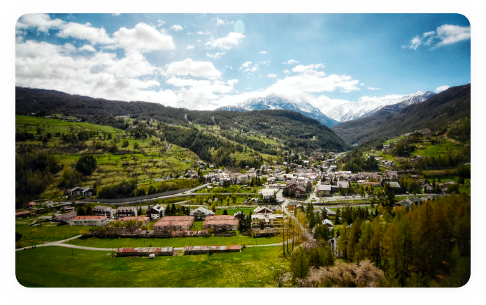
Access: from Cesana Torinese head towards Claviere as far as the bridge over the Piccola Dora and leave the car in the large clearing on the left. Continue along the river on the dirt road that almost immediately becomes a path, go beyond the Rocca Clarì cliff on the footbridge and continue along the path that runs by the river, pass the turnoff for the Bunker path until you reach another footbridge. Continue for a few hundred metres, until you reach the start of the Via Ferrata, very evident, located a few metres above the path itself (15 minutes).

Itinerary: Difficulty D+ via ferrata, development of bolted parts 750 m. time 3.30 h.

The equipped route spans the entire difference in height between the Piccola Dora stream and the peak of Rocca Clarì 2045 m. There are thus more than 550 metres of difference in height to cover, along an itinerary that without much beating about the bush climbs almost straight up to the peak. The very first part consists of an almost vertical pillar, then a traverse leads inside a typical gorge where two enormous limestone teeth are negotiated in succession, with sustained, aerial climbing, coming out on a ledge which joins up with the Bunker path. After a few bends, leave the path to turn left and go uphill through a rock barrier immersed in a larch wood. Another stretch of path in the wood leads to the base of the main wall, clearly visible from the road that climbs from Cesana to Claviere. 

Initially the path is partly vegetated, then, with an increasingly continuous and aerial climb, you reach the edge of the ridge, which you follow now to the right now to the left until you reach a beautiful ledge formed by an enormous boulder detached in the void. A vertical and very exposed dihedral leads up to a few metres from the summit, which is reached by a short gully, then a few more metres of path until a last equipped rocky outcrop that leads to the highest point. (3.30 h)

Descent: down a little marked path in a westerly direction, with short ups and downs over the long wooded summit of Rocca Clarì, you reach some old military posts, from which you descend a dirt road to “La Coche” (ski lifts); continuing along the dirt road you descend towards the village of Claviere. Just above it turn right, cross a ski lift to take the path that leads to the San Gervasio Gorge, until you reach the bottom (under the Tibetan bridge); descend the gorge along a beautiful path equipped with wooden walkways and bridges until you pass under the start of the Via Ferrata and then to the car park. (1.30 h)

EXCURSIONS - HIKES

For an exursion on foot among many walking suggestions

Tour of Mount Chaberton

The military road from Fenils to the summit is currently not passable following a municipal ordinance of 17/06/2020 prohibiting transit even on foot.


Site: http://www.piemonteoutdoor.it/it/attivita/escursionismo/tour-dello-chaberton

  • Length: 85 kilometres
  • Time taken: 20 hours
  • Degree of difficulty: EE
  • Difference in level: 3000 metres
  • Characteristics:
  • Stage 1 Oulx – Cesana Torinese
  • Stage 2 Cesana Torinese – Claviere
  • Stage 2A Rollieres – Fenils
  • Stage 3 Claviere – Plampinet
  • Stage 4 Plampinet – Oulx
  • Stage 4A: Stage 4 junction at Passo dell’Orso – Rey Refuge

The Chaberton Tour is a cross-border ring-route hiking trail that allows you to explore the heads of the Alpine valleys centred on Mount Chaberton, with stages that join the Sentiero Balcone (Balcony Trail) in the municipalities of Oulx and Cesana Torinese.

Hiking map

The whole area around Cesana Torinese is served by hundreds of kilometres of paths and dirt roads of great interest: the ancient paths connecting the villages, the military roads and mule tracks built for wartime and the magnificent network of paths that the Piedmont Region’s forestry team has restored or marked out in the last ten years are an ideal place for hiking or mountain biking. Particularly noteworthy are the trails in Val Thuras, in the area of Lago Nero and Monti della Luna, in the area of Champlas Seguin, Sansicario, Mollieres, Solomiac, Desertes, Fenils, the San Gervasio Gorge and Chaberton.

There are numerous refuges, restaurants and bars at high altitude where it is possible to refresh oneself from the exertions of your excursion.

Mountain Excursion Centre

Moon Mountain Company

Via Roma, 37
Cell: 339.7391727
Email: info@mountaincompany.it
Site: http://www.moonmountaincompany.it/

Mountain excursion centre with nature guides

MOUNTAIN-BIKE ITINERARIES

Hundreds of kilometres of paths and dirt roads of outstanding quality

Alta Quota Sport

Piazza Vittorio Amedeo e Frazione San Sicario Alto
Cell: 333.6463577
Sito: www.altaquotasport.it

Accompanied mountain bike tours. E-bike rental (pedal-assisted bikes)

Monti della luna

Sito web: http://www.piemonteoutdoor.it/it/attivita/escursionismo/tour-dello-chaberton

Starting point: Cesana Torinese

Arrival point: Claviere

Length: 28 kilometres

Degree of difficulty: difficult

Height difference: 1180 metres

Moon Mountain Company

Mountain excursion centre with nature guides

Sansicario Bike

Centro Commerciale San Sicario Alto, Residence 54
Cell: 335.6089452

E-bike rental and bike workshop

FIND OUT MORE ABOUT BIKE ITINERARIES

SKI TOURING, SNOWSHOEING AND CROSS-COUNTRY SKIING

Not just speed and daring descents on the snow

Ski Touring

In the Cesana Torinese area several itineraries allow you to practice ski touring.

In Val Thuras, we recommend: Punta Ramière, Colle del Pelvo, Punta Ciatagnera, Roc del Boucher, Cima del Bosco, Punta Merciantaira, Monte Terra Nera, Cima Dormillouse, Monte Giaissez, Colle Chabaud and Col Begino. In the Monti della Luna area there are: Cima Fournier, Col Bousson and Cima Saurel. Also of note is Mount Chaberton and, starting from Fenils, Punta Rochers Charniers and the Punta Chalanche Ronde.

Snow shoes

Snowshoes are the oldest piece of equipment for moving around easily in winter when the mountains are covered in snow. With snowshoes it is possible to hike over the white and sometimes immaculate snow cover and rediscover the pleasure of moving slowly, savouring the silence of the woods and the suggestive lights that winter offers.

Away from the busiest areas, walking through the larch and stone pine woods, it is easy to see traces of wild life in the woods on the snow and sometimes even come across the animals themselves (roe deer, chamois, deer, ermine, squirrels, nutcrackers, eagles, wolves and typical alpine fauna). The routes indicated are considered safe in normal weather and snow conditions but are not kept under surveillance, so before embarking on any excursion, it is advisable to

Varying environmental conditions can lead to a significant drop in safety levels. In the event of a high risk of avalanches, it is not advisable to undertake any excursion.

It is recommended to wear appropriate clothing and footwear for winter mountain conditions and to carry self-rescue equipment: ARVA avalanche transceiver, shovel and probe. Use this topographic map and weigh up the choice of itinerary in advance; each individual should choose the routes to be followed as per their technical and physical abilities and the equipment available.

All indicated routes are marked with signs, posts and symbols. The trails signposted are only created by people walking over them: there is no mechanical, daily or periodic maintenance service.
In order not to disturb the wildlife, lose your bearings or run the risk of an accident, it is recommended that you follow the routes and scrupulously respect the areas designated for crossing the ski slopes, remaining cautious, making your presence known and always giving priority to skiers.

Some of the high-altitude trails are easily reached using the ski lifts from Cesana. Do not throw away your rubbish but take it with you, picking up any waste left by others. Along the routes you will find a number of refreshment and accommodation points marked on the map.
The walking times indicated are average and approximate and may vary considerably depending on snow conditions and your own ability. All routes are practicable in both directions.

In case of emergency call 118 – mountain rescue service:

  • give your personal details
  • where you are (if possible, GPS coordinates)
  • your cell phone number
  • describe the type and seriousness of the accident
  • indicate the number of people involved
  • remain on the spot at the disposal of the rescuers

Download the Snowshoe Trail Maps

1 . Snowshoe map

2 . PDF itineraries map

YOU HAVE NOT FOUND
WHAT WERE YOU LOOKING FOR?

Fill out the form!

To receive all the information you need please fill out the form or write to us at info@comune.cesana.to.it if you want to contact the Municipality or visit the website comune.cesana.to.it

We will answer you as soon as possible!

    All fields marked with the symbol * are required